Best apps to plan a trip with friends (2026)
Updated July 11, 2026
Planning a trip together almost always starts in a group chat, and that is where it falls apart. Someone drops a link to a restaurant, a few people react with a thumbs-up, and by the next morning it is buried under a hundred messages about who is bringing the speaker and whether the flights are refundable. The good suggestions do not disappear, exactly. They just become impossible to find again.
So one person quietly appoints themselves the planner. They scroll back through weeks of chat, copy links into a notes app, and try to reconstruct what everyone actually wanted. It is thankless work, it is easy to get wrong, and it means the rest of the group has stopped contributing because there is no obvious place to contribute to. The trip gets planned, but by one tired person instead of the group that is supposedly going together.
The right app fixes that by giving the group a single place to gather ideas and, just as importantly, a way to decide between them. Gathering is the easy half. Deciding, without a fifty-message argument about which neighborhood to eat in, is the half most tools ignore. Here are the best ways to plan a trip with friends in 2026, and who each one is for.
What makes a good group-trip app
A few things separate an app that a group actually sticks with from one that gets abandoned by day two, when everyone drifts back to the group chat because the tool was more friction than the problem it solved.
- Real-time editing, so everyone can add and change things at once without stepping on each other or waiting for a refresh. If two people cannot add a spot at the same moment, the group defaults back to one person doing the typing.
- A way to decide, like voting, so a pile of suggestions turns into an actual plan instead of an endless debate. Collecting fifty ideas is easy. Turning them into “yes, these twelve” is where trips stall.
- Cross-platform access, so the friend on Android and the friend on a laptop are not locked out of their own trip. An Apple-only tool quietly excludes whoever did not buy the right phone.
- Low friction to join, ideally a link that opens without forcing everyone to create an account first. Every required signup is a person who never looks at the plan.
- A real map, so you can see what is near what and build a sensible day instead of crisscrossing the city three times because nobody realized two of the spots were on the same block.
Hold those five up against any app and the good ones separate from the merely popular quickly.
Places, best for planning on one live map
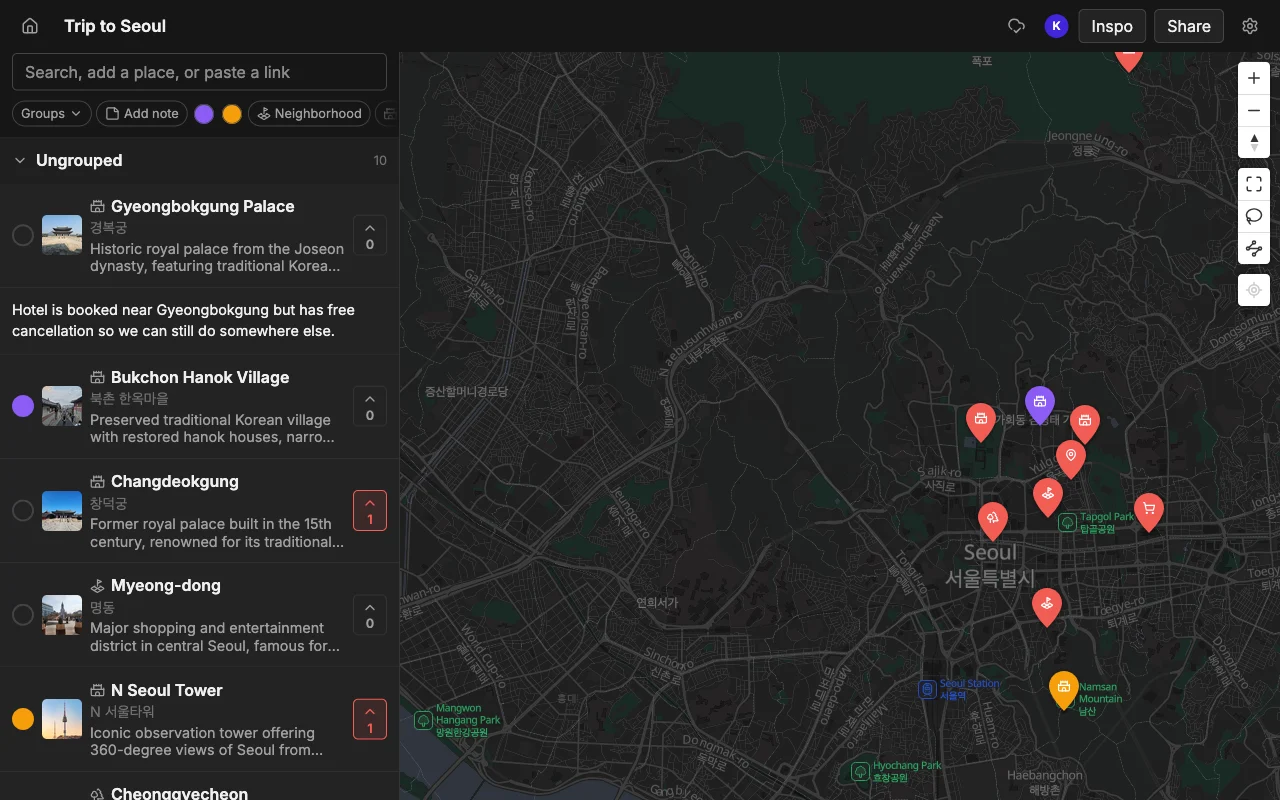
Places is built for exactly this. Everyone edits the same map in real time, so when your friend adds a bakery in Seoul you see it appear on your screen a second later, no refresh, no “did you get my message.” The group votes on spots to decide together, which is the feature that actually ends debates: instead of arguing in text, everyone taps the places they want, and you can see at a glance which spots have the most support. Each place holds a note, so the context that would have been lost in the chat lives right on the pin.
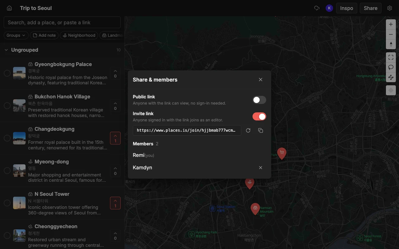
It runs on the web, iPhone, and Android, so nobody is left out over a device choice, and you can share a read-only link that anyone opens without an account. That last part matters more than it sounds: the cousin who is maybe coming, or the local friend giving suggestions, can see the whole plan and add their two cents without a signup wall stopping them at the door.
Getting ideas onto the map is quick, which keeps the group actually using it. Paste a TikTok, a Reel, or an article and every spot lands automatically with a photo and a short description, or add places by searching when the tip came from a text or a guidebook. From there, colors, lists, and notes turn a scatter of pins into something that reads like a plan: one color for food, one for the museums, a list per day, a note on which place needs a reservation. Places is free to start, with unlimited maps, places, and collaborators. When the plan is set, you can export it to KML, CSV, or PDF to bring along or share. Best if you want one shared, living map the whole group builds and decides on together.
Wanderlog, best for flights, hotels, and a day-by-day plan
Wanderlog adds real logistics on top of a map: reservations, driving times, and a structured day-by-day itinerary, and it supports collaboration so the group can build it together. For a trip that is mostly about getting from booking to booking, a road trip with five hotels and a rental car, that structure is useful. It answers “how long from here to there” and “what are we doing Tuesday” in a way a plain map does not.
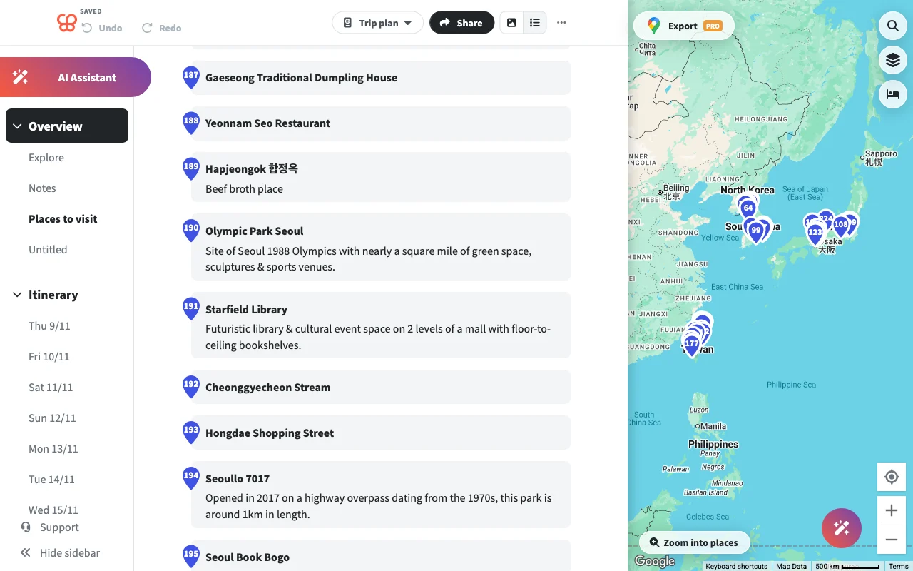
The trade-offs show up when the trip is still taking shape rather than already booked. It can slow down on very large trips once the itinerary gets long, it does not import from social videos, so the TikTok spots go in by hand, and the day-by-day layout can feel rigid before you have actually decided anything. Structuring an hour-by-hour Tuesday is premature when the group has not even agreed on which city gets the extra night. It is a strong finishing tool and a weaker brainstorming one. Best if your trip is mostly about flights, hotels, and routing.
Google My Maps, best for a simple free custom map
Google’s My Maps lets several people build a custom map for free, which sounds perfect until you use it together. The catch is that edits are not live: everyone has to refresh to see what changed, so two people working at once end up confused about whose version is current, and there is no way to vote, so the deciding still happens somewhere else. It gives you a shared surface but not a shared moment.
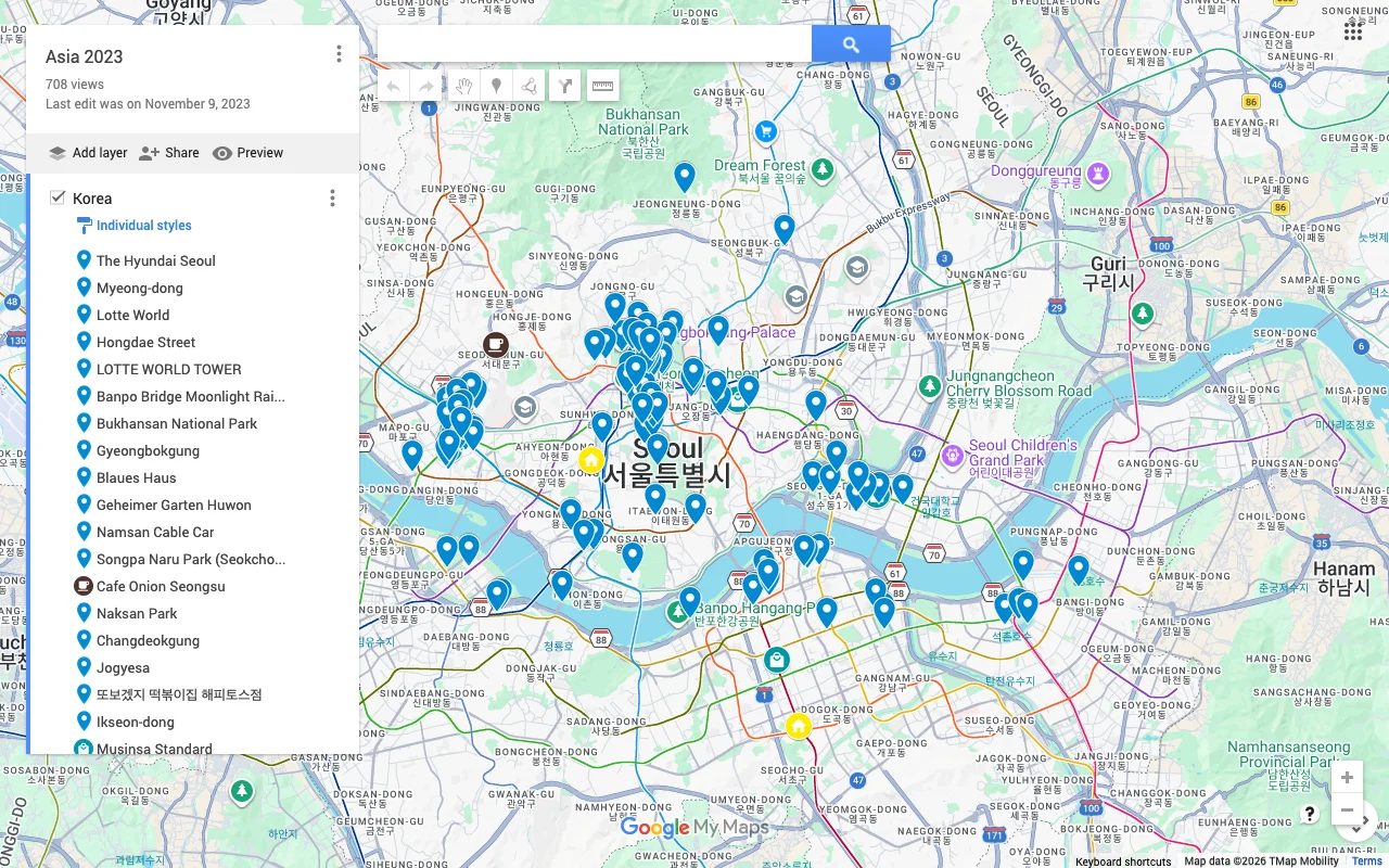
It is also desktop-first and awkward on a phone, which is a real problem for a travel tool, since half the useful additions happen while someone is actually out exploring and wants to drop a pin from the sidewalk. For a static map you build once at a laptop and mostly read later, it is free and it works. For a plan that evolves as six people add to it, the missing live editing and voting show quickly. Best for a basic shared map when live editing does not matter.
Notion or Google Docs, best for total flexibility
A shared doc can hold anything: budgets, packing lists, flight numbers, and free-form notes that do not fit neatly into any app’s boxes. If your group already lives in Notion or Docs, it is one less tool to learn and one less signup to chase people through, and for the writing around a trip it is a natural fit.
The catch is that a doc has no map and no idea what a place is. You type every address yourself, you never see the geography of the trip, and you cannot tell at a glance that three of your dinner spots are inconveniently spread across the city. See Places vs Notion and Google Docs for the full comparison. A doc is a great home for the words and numbers of a trip and a poor home for its places, which is why most groups end up pairing one with a real map rather than choosing between them. Best for the writing around a trip, paired with a real map for the places themselves.
Mapstr, best if you already share saved spots
Mapstr has shared maps, but they work differently than a group planner needs them to: they are add-only, so friends can drop pins, yet only the creator can change or remove them, and there is no voting to sort the good from the maybe. That makes it a shared pool of suggestions rather than a plan the group shapes together. If one person is curating and everyone else is just contributing tips, that model is fine.
Its real strength is following other people’s maps, a friend’s, a chef’s, a favorite publication’s, rather than co-planning one specific trip. As a way to see where the people whose taste you trust have been, it works well and is long-established. As the single surface where four friends hash out a week in Portugal, the missing live co-editing and voting hold it back. Best if your group already saves and shares spots in Mapstr and just wants a common pool.
How to choose
Match the tool to the hard part of your particular trip. If your trip is mostly logistics, a chain of flights, hotels, and drives, Wanderlog earns its place with real itinerary structure. If your group already lives in a doc, Notion or Docs is one less tool to learn and a fine home for the budget and the notes. If you already curate spots in Mapstr, its shared map is a reasonable common pool.
But if the hard part is what it usually is, gathering everyone’s ideas and actually deciding together, then a live shared map with voting is the one that holds up when six people are all adding at once. That is the scenario that breaks the group chat and the static map alike, and it is where Places fits. Pick for the bottleneck, not the feature list, and the choice gets easy.
Frequently asked questions
- Does everyone need to download an app to plan together?
- No. A read-only link opens in any browser, so anyone can see the plan without installing anything, and only people who want to edit need an account. Nobody is forced to sign up just to look at where you are going.
- How do we decide without arguing?
- Vote on spots right on the map. Instead of a fifty-message thread where the loudest opinion wins, everyone taps the places they want, and you can see which spots have the most support, which turns a debate into a quick tally.
- Can we plan more than one trip in the same app?
- Yes. Make a separate map for each trip and share each one with whoever is coming, so the summer group and the ski group are not tangled together and each set of friends only sees their own plan.
- What about the friend on Android or a laptop?
- They are fully in. A good group-trip app runs on the web, iPhone, and Android, so device choice never quietly excludes anyone, which is exactly why Apple-only tools struggle for mixed groups.
- Can we pull in places from TikTok or Instagram instead of typing them?
- With Places you can: paste a TikTok, a Reel, or an article and each spot lands on the map with a photo and a note. Most itinerary and doc-based tools make you add every place by hand.